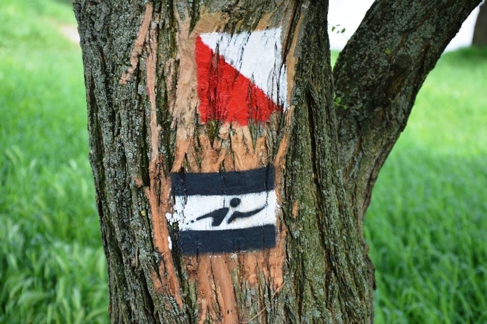
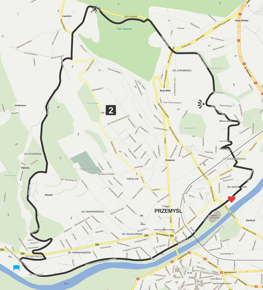
Having in mind people walking with poles two routes have been marked out in Przemyśl: a 6,9km loop marked with red signs and a longer black route of 11.5km requiring a certain level of fitness. This route also creates a loop. This allows for entering the routes both through the starting points (the Castle Park and John Paul II Bank accordingly) as well as joining on the way at any point in the city, following the characteristic signs with a man with poles on them.
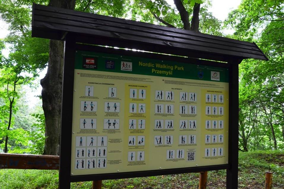
The routes are equipped with boards containing maps and routes descriptions as well as information which help you become aware Nordic walkers. How to choose the equipment, the levels of Nordic walking, example of exercises - these are only examples of the information you can find on the boards.
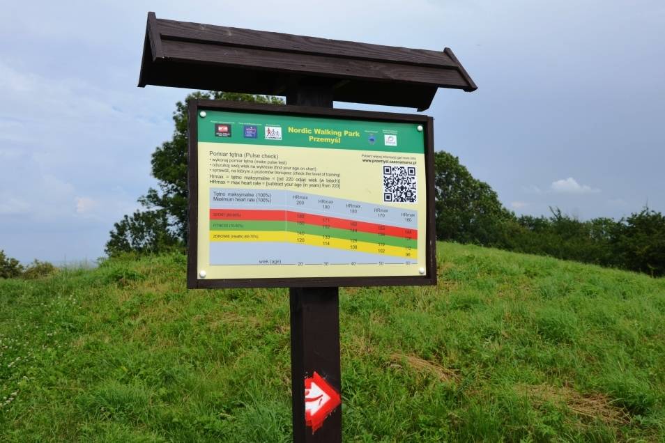
The whole is complemented by pulse measurement points together with information on the level we are walking at (health, fitness, sport). Przemyśl Nordic walking park is marked in accordance with the Nordic Walking Park® standard, which has been applied on 1000km of routes in Poland. Owing to that the routes in Przemyśl have received the route certificate awarded by Polish Nordic Walking Association, which recommends them as appropriate for Nordic walking.
Black route: length 11.5km, estimated walking time 2h
Long, high impact route requiring high level of fitness marked, out in the left bank Przemyśl.
The starting point is located near the bus stop on John Paul II Bank. The initial section of the route goes along the promenade by the river San. We reach Orlęta Przemyskie Bridge and walk eastward on the pavement along 22 stycznia Street. We pass the stadium of Czuwaj sports club and under Ryszard Siwiec bridge we reach a path crossing a meadow by the San. We reach a playing field visible in the distance, where the pulse measurement point is located. Having read the pulse range for th route we move on and following the route's signs we come back to the pavement.
We put on asphalt paws and passing ZUS building we start climbing Winna Góra (Wine Mountain). The name is connected with wineries which were set up here as early as the Middle Ages. After 5km from the begining of the walk there is a surprise awaiting us - a beautiful panorama of the city. We move on and having crossed Krakowska Street we enter the alleys of the Castle Park.
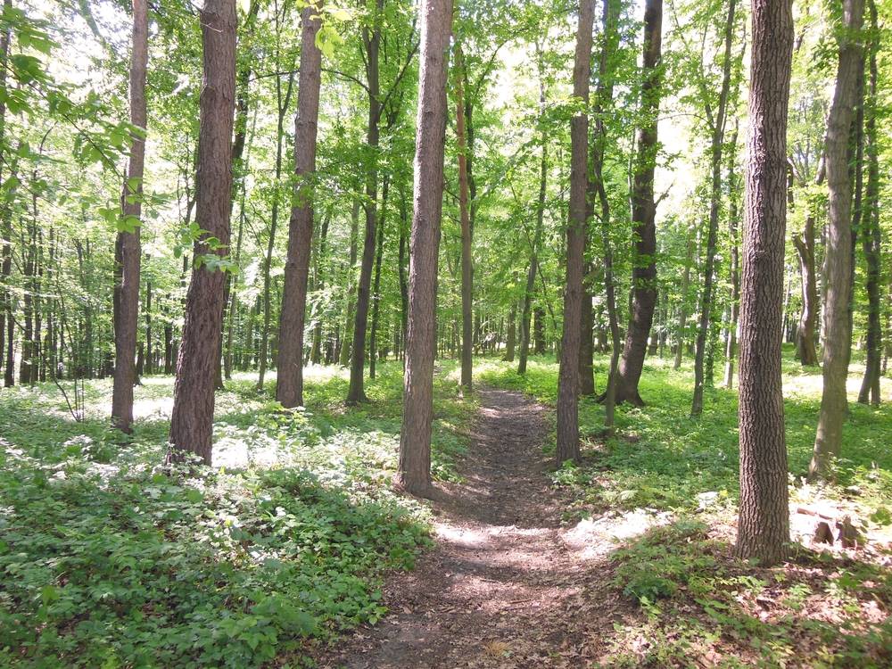
The exercise board located here contains suggestions of exercises. All we must do is choose one and... start doing it. Having finished the exercises we leave the Park and along Armii Krajowej Street and Paderewskiego Street, along a shortcut through the woods we reach Marcina Bielskiego Street. After a few kilometres downhill and having crossed Grunwaldzka Street we reach the bus stop where we started our walk. Not forgetting about stretching exercises (propositions on the board) we finish our walk.