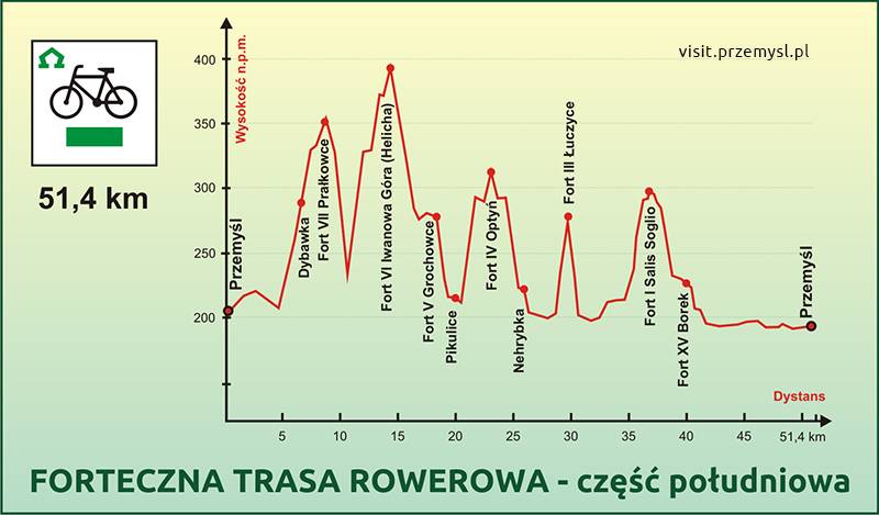
Fort VII "Prałkowce"
Fort VI "Iwanowa Góra" (Helicha)
Fort V "Grochowce"
Fort IV "Optyń"
Fort III "Łuczyce"
Fort I "Salis Soglio"
Fort XV "Borek"
Przemyśl (0,0 km) - Dybawka (6.6) - Fort Prałkowce (8.5) - G. Wapielnica (13.8) - Fort Helicha (14.6) - Fort Grochowce (17.5) - Fort Optyń (22,0) - Łuczyce (27.5) - Fort Siedliska (35.5) - Fort Borek (37.0) - Przemyśl (48.8 km)
0.0 km - we set off from the car park by the artificial skating rink in Sanocka Street.
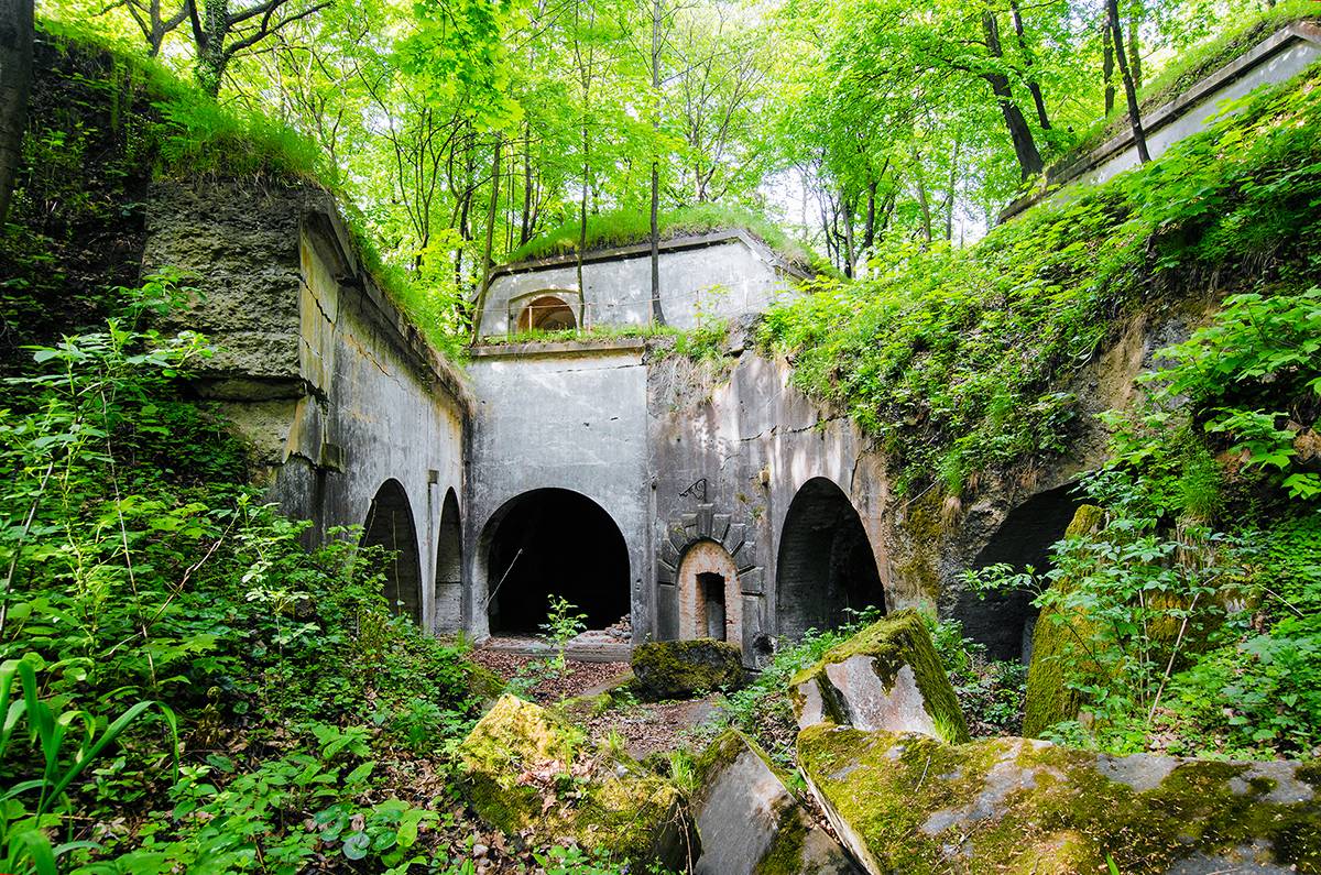
6.6 km - the top of the hill in the village of Dybawka and the start of the „Fortress" black hiking trail. 8.5 km - we reach the area of Fort VII Prałkowce.
13.8 km - at the top of the mountain Gora Wapielnica we find a number of roads and tourist trails crossing over.
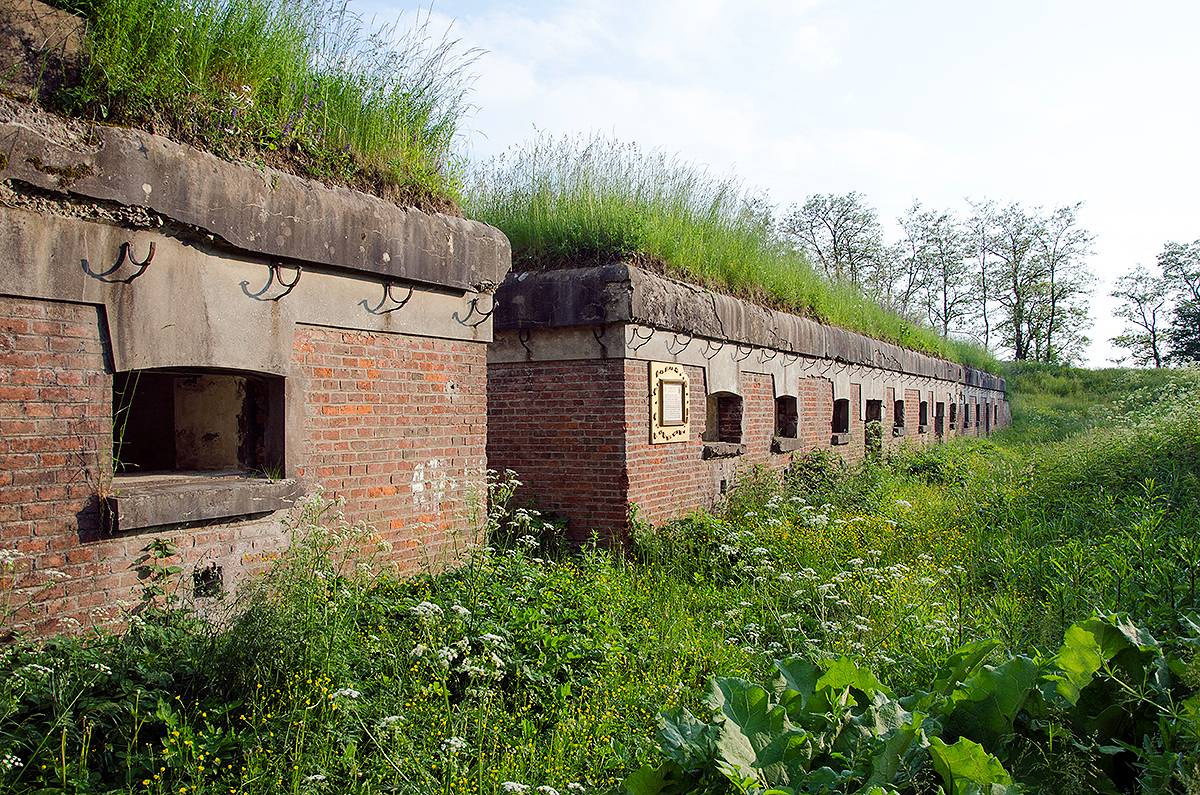
14.4 km - our road turns right slightly uphill leading to Fort VI Helicha (ca. 150 m). It is the highest spot of the whole route.
17.5 km - a dirt road turns right, leading to Fort V Grochowce.
18.3 km - already in Pikulice, on the crossing with an asphalt road, we turn left.
19.1 km - we pass a church on our right, and then a cemetery.
20.5 km (23.7 km) - At the broad bend of the road leading right, we pass (on our left) an old electric pylon, witness back to the FWW. Here, a gravel road turns left, a little downhill, which is part of our „fortress trail". Before we take it, however, we go uphill to Fort IV Optyń.
24.5 km - a crossing with an asphalt road in the village of Nehrybka.
25.9 km - following the signs of the bicycle route we get to the unused railway tracks. Straight ahead of us is the hill with Fort III Łuczyce. Behind the tracks - a dirt road.
26.9 km - we reach a small footbridge over the river Wiar in the village of Łuczyce.
27.8 km - here the asphalt road turns left and leads us through the village of Krówniki to PrzemyśI. The fortress trail" goes straight on, along a level surface, now a gravel path, almost exactly eastwards.
30.8 km - a crossing of gravel paths. To Krówniki and PrzemyśI we could go left. We, however, turn right. 31.6 km - a stony road turns right leading to Fort II Jaksmanice.
34.7 km - in Siedliska, on the crossroads, we turn right, and head towards Fort I Salis Soglio.
35.5 km - From Fort I Salis Soglio we return first by the same way through Siedliska, but about 600 m away from the fort we turn right towards the last fort on that route, Fort XV Borek.
37.0 km - right before the fort (Fort XV Borek was once cleared of overgrowth and well visible but now it is overgrown again) we turn left and ca. 300 m later we return to asphalt.
38.6 km - on the crossroads with the busy road PrzemyśI-Medyka we turn left.
43.6 km - Right past the bridge on the river Wiar we turn into the first street on the right.
48.8 km - we end our ride at the railway bridge in the centre of Przemyśl.